
VibeGeo Technologies is an authorized reseller of Terrasolid software for India & SAARC Countries.
Terrasolid is high-end processing software for LiDAR point cloud data from Airborne-based, Vehicle-based, Terrestrial-based and UAV / Drone-based LIDAR systems. Terrasolid develops software products that are used world-wide for processing point cloud and image data from airborne and mobile LIDAR systems. Terrasolid offers a variety of tools for viewing, analyzing and extracting features from 3d point clouds accurately and efficiently. Additional modules offer workflows for LIDAR sensor calibration and point cloud data correction, surface modeling and orthophoto generation from LIDAR and imagery.
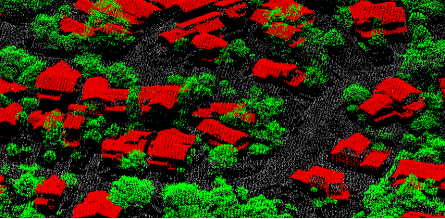
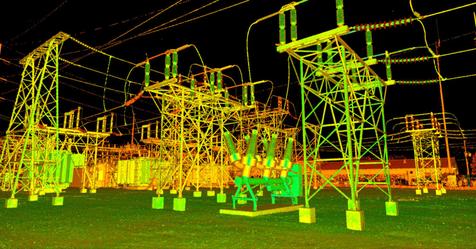
TerraScan is the main application in the Terrasolid Software family for managing and processing all types of point clouds. It offers import and project structuring tools for handling the massive number of points of a laser scanning campaign as well as the corresponding trajectory information. Various classification routines enable the automatic filtering of the point cloud.
TerraScan supports several import and export formats, including the LAS and LAZ formats, TerraScan Binary and TerraScan Fast Binary formats, as well as ASCII formats that can be defined according to the users’ needs.
Visit Terrasolid for more details
TerraMatch – Improve the accuracy and quality of raw point clouds
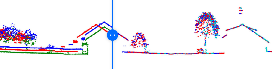
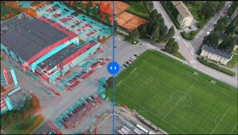
TerraMatch is a sophisticated tool for improving the accuracy and quality of the raw laser point cloud. It compares laser data from overlapping flight or drive paths and calculates correction values for the misalignment angles as well as xyz location errors. The comparison and correction value calculation can be either based on surface matching or on different types of tie lines. Tie line matching comprises points or lines on horizontal, vertical or sloped surfaces that can be used for matching flight/drive paths to each other, but also known point or line locations that enable the adjustment of the laser point cloud to control measurements.
Visit Terrasolid for more details
TerraPhoto – Produce orthorectified images from airborne images
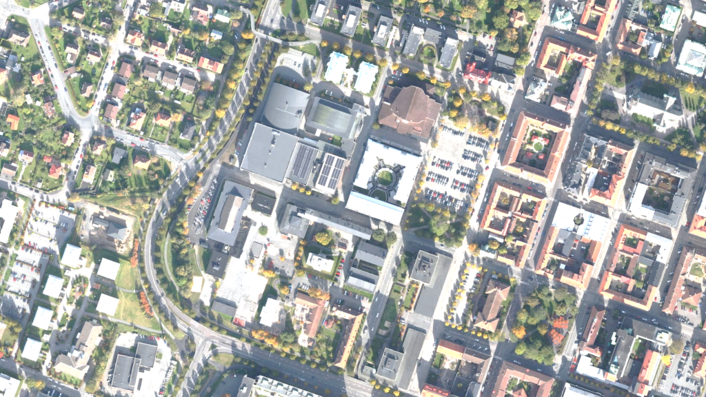
TerraPhoto is specifically developed for processing images captured together with laser data during a survey mission. The software enables the production of rectified images and ortho mosaics based on ground model that has been extracted from the laser data. The positioning of the source images can be refined by using tie points for image-to-image adjustment while ground control point can be involved for improving the absolute accuracy of the image block. With additional functionality, such as color adjustment options, the creation of selection shapes for several object types or areas (e.g. buildings, water), the inclusion of vector models for true-ortho photo production, TerraPhoto lets you create ortho photos of good positional and color-coordinated quality.
Visit Terrasolid for more details
TerraModeler – You can create, edit and utilize surface models
TerraModeler can create, edit, and utilize surface models (TINs) from various sources, such as LiDAR points stored in binary files, XYZ ascii files and graphical breakline elements for delivering the best possible results for the analysis or end product. The software offers versatile visualization options including colored shaded surfaces, contour lines, grids, colored triangle nets, elevation texts, slope directions and textured surfaces.
Additional functionality includes the production of contour lines and lattice models in batch processing, modification of the TIN, creation of profiles, calculation of volumes, calculation of elevation or volume differences between two surface models, several labelling options as well as other tools for design purposes. Completed with various export options.
Visit Terrasolid for more details
TerraStereo – Stand-along application for visualizing very large point clouds
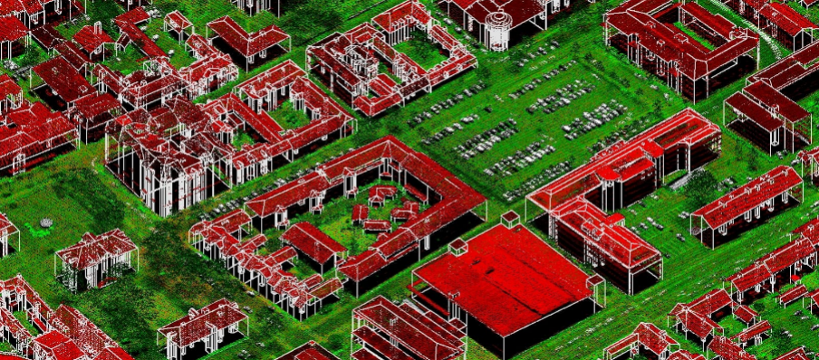
TerraStereo is a stand-along application for visualizing very large point clouds. It uses high-performance graphics boards for rendering huge amounts of points fastly and in high quality. The software enables you to:
- visualize up to 50 billion points that are organized in a TerraScan project
- perform visual analysis and quality check in both, small and large scale displays
- navigate through the point cloud freely or based on TerraScan trajectory files
- easily change between different display channels and point rendering modes
- view point clouds in different colour modes as Elevation, Intensity And Class Value, RGB Values.
- use elevation exaggeration to the point cloud for specific analysis tasks.
- digitize line vector elements and export them to TerraSurvey.
Visit Terrasolid for more details
TerraSurvey – Handles Data from Total Stations and GPS Devices
TerraSurvey handles data from field surveying with total stations and GPS. It reads-in survey data from text files and creates a survey drawing as 3D design file. It recognizes automatically a number of survey data formats that are produced for example by Trimble, Leica or Sokkia surveying instruments. By defining your own file format you can read-in practically any files, which are organized in columns and contain coordinate or angle values.
Use TerraSurvey in combination with TerraPhoto and TerraScan you can improve the absolute accuracy of image positions in an image list by using ground control points from TerraSurvey. You can also assign feature codes to vectorized objects such as power line wires or road break lines, which have been vectorized or digitized in TerraScan.