VibeGeo & Planet Partnership
Transforming Satellite Imagery into Actionable Insights
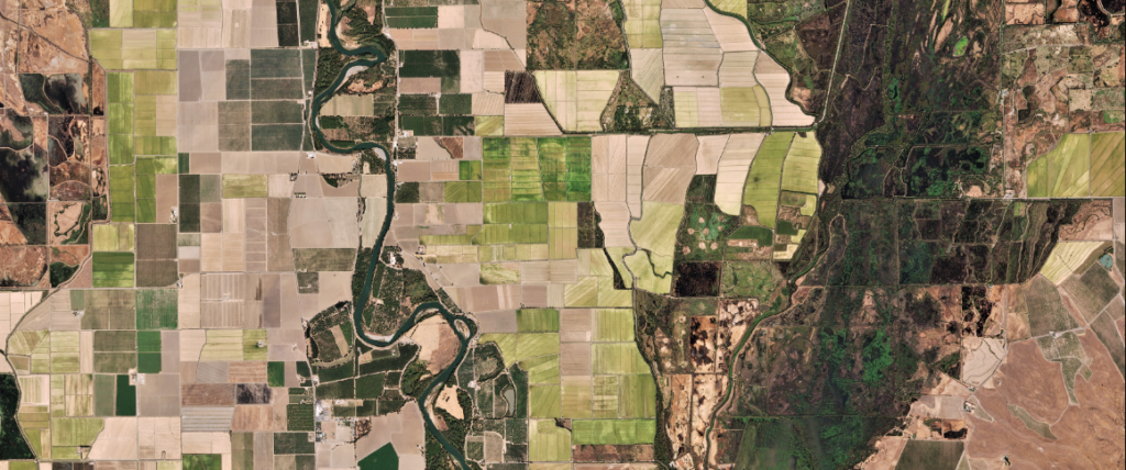
Planet provides high-resolution daily satellite imagery of the entire Earth to help businesses, research institutes, and governments identify spatial patterns, detect environmental changes, and make mission-critical decisions.
DAILY GLOBAL MONITORING
Planet Monitoring
Leverage the power of 200+ Dove satellites capturing 3.7-meter resolution imagery of the entire Earth daily. Monitor environmental shifts, seasonal developments, or infrastructure growth in real-time with comprehensive archive lookup and direct API integrations.
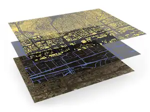
HIGH-FREQUENCY MOSAICS
Planet Basemaps
Empower deep time-series analysis and machine learning workflows by combining daily imagery into visually consistent, cloud-free, and scientifically accurate global mosaics. Mitigate light, haze, and terrain effects to capture actual ground truth.