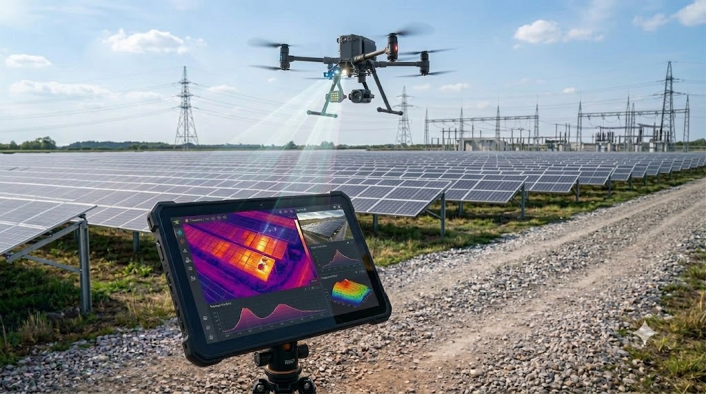
From utility-scale solar parks across Rajasthan and Gujarat to high-voltage power grids and industrial chemical plants, enterprise drone inspections are undergoing a massive shift.
Capturing standard RGB visual photos is no longer enough. To detect hidden defects, preventative maintenance teams increasingly rely on thermal infrared drone payloads (such as the DJI Zenmuse H20T, H30T, Mavic 3 Enterprise Thermal, and FLIR cameras).
However, traditional drone software often treats thermal captures as simple “color heat snapshots”—stripping away the raw scientific temperature data.
With PIX4Dmatic’s advanced Radiometric Thermal Processing, that limitation is gone. Surveyors and inspection engineers can now process thousands of thermal drone images to generate georeferenced, millimeter-accurate 2D and 3D radiometric thermal orthomosaics, where every single pixel stores the exact temperature value in Celsius or Fahrenheit.
1. The Critical Difference: Visual Thermal vs. Radiometric Thermal
Not all thermal maps are created equal:
- Standard Visual Thermal: Generates a basic colorized picture (ironbow or grayscale). While you can see that an area is warmer than its surroundings, you cannot measure the exact temperature or run calibrated mathematical analysis.
- PIX4Dmatic Radiometric Processing: Preserves the underlying radiometric temperature metadata embedded in each camera pixel. In PIX4Dmatic, clicking anywhere on a solar panel or electrical insulator instantly displays the true, calibrated temperature reading (e.g., 68.4∘C).
This allows engineering teams to identify whether a hot spot is within acceptable operating limits or represents an imminent fire hazard.
2. High-Speed Processing for Massive Industrial Datasets
Utility-scale solar farms can span hundreds of acres and produce over 10,000 thermal images in a single flight session. Older photogrammetry tools often choke or take several days to calibrate thermal imagery due to lower image resolution and low contrast.
PIX4Dmatic is purpose-built to eliminate this bottleneck:
- Up to 5x Faster Processing: Harnesses multi-threading and modern GPU acceleration to process massive solar and corridor datasets in a fraction of the time.
- Broad Thermal Hardware Support: Fully compatible with industry-standard radiometric cameras from DJI, FLIR, and Skydio.
- Dual Alignment (Thermal + RGB): Seamlessly correlates thermal imagery with high-resolution RGB visual orthomosaics and Digital Surface Models (DSMs), giving inspectors both the exact physical condition and the underlying thermal signature.
3. Key Industrial Applications in India
A. Solar Farm (Photovoltaic) Health Audits
Defective bypass diodes, cracked solar cells, bird droppings, and string failures cause severe power loss and fire risks. With PIX4Dmatic, solar asset managers can scan an entire 100 MW solar plant, pinpoint malfunctioning cells, and export georeferenced anomaly reports for rapid on-ground maintenance.
B. Power Transmission & Substation Diagnostics
Substations and high-voltage transmission lines generate intense electrical heat when connections loosen or insulators degrade. Thermal drone mapping identifies overheated transformer bushings, switchgear contacts, and phase imbalances without requiring hazardous power shutdowns.
C. Building Energy Audits & Roof Moisture Detection
Detect insulation leaks, thermal bridging in structural concrete, and trapped moisture beneath commercial roofing membranes before structural degradation occurs.
D. Industrial Refineries & Pipeline Monitoring
Monitor underground gas pipelines, thermal expansion in petrochemical plants, and storage tank fluid levels with non-invasive aerial thermography.
Why Procure Pix4D via VibeGeo Technologies?
As an Official Authorized Reseller of Pix4D in India, VibeGeo Technologies Pvt. Ltd. provides complete software licensing, technical onboarding, and after-sales support:
- Official, Genuine Licenses: Perpetual licenses, annual subscriptions, multi-seat enterprise floating licenses, and upgrades across the complete Pix4D portfolio.
- Best Competitive Market Pricing: Guaranteed industry-best pricing on PIX4Dmatic, PIX4Dsurvey, PIX4Dmapper, and PIX4Dfields.
- Attractive Discounts for New Customers: Exclusive introductory discounts, bundle packages, and volume savings tailored specifically for new clients, survey contractors, and enterprise drone service providers.
- Certified Practical Training: Hands-on training on real-world radiometric thermal and photogrammetry datasets, training your team on flight planning, camera emissivity settings, and report generation.
- Global Technical Support: Instant telephonic helplines, email, and live remote diagnostic support from certified geospatial engineers—supporting your projects seamlessly not just in Kolkata or India, but anywhere in the world.
🎁 Exclusive Offer for New Customers:
Upgrading your inspection workflows with thermal drone mapping? Contact VibeGeo today to claim your exclusive new-customer discount on PIX4Dmatic and request a free trial license.
📩 Request a Quote & Demo License: Contact VibeGeo Team
🌐 Explore Pix4D Solutions: Visit VibeGeo Pix4D Page
📞 Direct Helpline:+91-99038-97065 |info@vibegeo.com