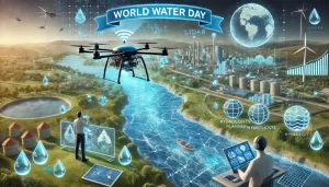
Every year on March 22, World Water Day raises awareness about the
global importance of freshwater and sustainable water management.
From water scarcity and pollution to the growing threat of climate
change, protecting our water resources has never been more critical.
At VibeGeo Technologies — the authorized Terrasolid partner in India
— we believe LiDAR technology plays a vital role in addressing these
challenges across India and the SAARC region.
LiDAR (Light Detection and Ranging) uses laser pulses to generate
highly precise 3D maps of landscapes, water bodies, and infrastructure.
For water management professionals — including hydrologists, urban
planners, and environmental scientists — LiDAR data processed through
Terrasolid software provides unmatched accuracy and efficiency.
1. 🌊 Flood Prevention
High-resolution topographic maps generated from LiDAR data help
identify flood-prone areas across India. Government agencies and
disaster management teams can make better decisions using accurate
terrain models processed with TerraScan and TerraModeler.
2. 🏞️ Watershed and River Analysis
Precise LiDAR terrain data supports the design of efficient water
distribution systems and river management strategies — critical
for water-stressed regions across India and South Asia.
3. 🌿 Wetland Conservation
Regular LiDAR surveys help monitor changes in water levels and
vegetation cover, enabling better ecological preservation of
India’s wetlands and natural water bodies.
4. 💧 Groundwater Recharge Mapping
By identifying infiltration zones and soil permeability patterns
through LiDAR analysis, water authorities across India can develop
sustainable groundwater recharge and management strategies.
5. 🌊 Coastal Protection and Erosion Monitoring
LiDAR mapping of India’s coastline helps track erosion patterns,
supporting climate adaptation strategies and long-term coastal
resilience planning.
As the authorized Terrasolid partner in India and SAARC region,
VibeGeo Technologies provides advanced LiDAR data processing
solutions that improve the accuracy and usability of water management
data. Using Terrasolid’s industry-leading software — including
TerraScan, TerraMatch, TerraPhoto and TerraModeler — hydrologists,
urban planners, and environmentalists across India can efficiently
process, analyze, and visualize LiDAR data to create effective
water management strategies.
Whether you need official Terrasolid software licenses, expert
training, or dedicated technical support in India, VibeGeo is
your trusted partner.
With the integration of LiDAR, Artificial Intelligence, and GIS
technology, smarter data-driven water management strategies are
becoming a reality across India. Investing in these technologies
today helps ensure clean, accessible water for future generations.
By leveraging Terrasolid’s innovative LiDAR processing solutions
available through VibeGeo in India, organizations — from government
agencies to private engineering firms — can make informed,
data-backed decisions for better water management worldwide.
Ready to leverage LiDAR technology for water management projects
in India? Contact VibeGeo Technologies — the authorized Terrasolid
partner in India and SAARC region.
📞 Call: +91 98304 26829
📧 Email: info@vibegeo.com
🌐 Website: vibegeo.com/terrasolid-authorized-reseller-india-saarc/
#World Water Day #LiDAR #Terrasolid #Water Management India
#LiDAR India #Terrasolid Partner India #VibeGeo
#Flood Management LiDAR #TerraScan India