CORE CAPABILITIES
Technology Domains
Deploying state-of-the-art sensory technologies, AI-powered point cloud classifiers, and advanced photogrammetric processing to map our world with extreme accuracy.
CORE CAPABILITIES
Deploying state-of-the-art sensory technologies, AI-powered point cloud classifiers, and advanced photogrammetric processing to map our world with extreme accuracy.
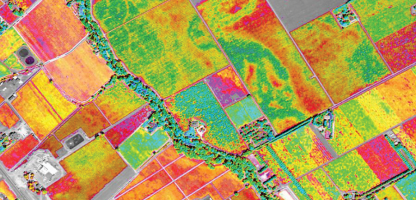
SATELLITE & UAV MULTISPECTRAL
We process multi-band and hyperspectral satellite imagery to classify vast territories, monitor crop health, track environmental changes, and analyze potential geohazard risks.
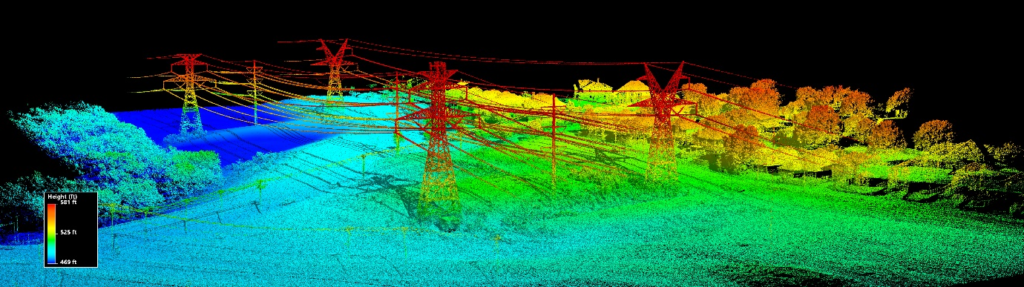
ACTIVE SENSOR LASER DATA
Acquiring and processing dense calibrated laser returns from airborne, mobile, and terrestrial sensors to construct ultra-precise 3D point cloud models of terrain structures.
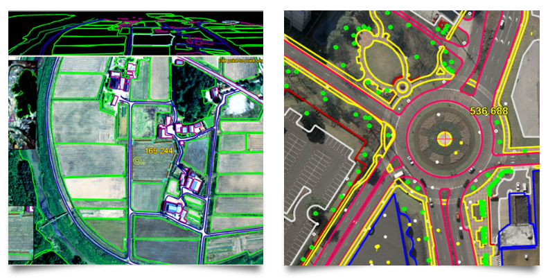
AERIAL METRIC CALIBRATION
Triangulating and matching digital aerial and drone imagery to generate pixel-perfect orthophotos, detailed digital surface models (DSM), and volumetric measurements.
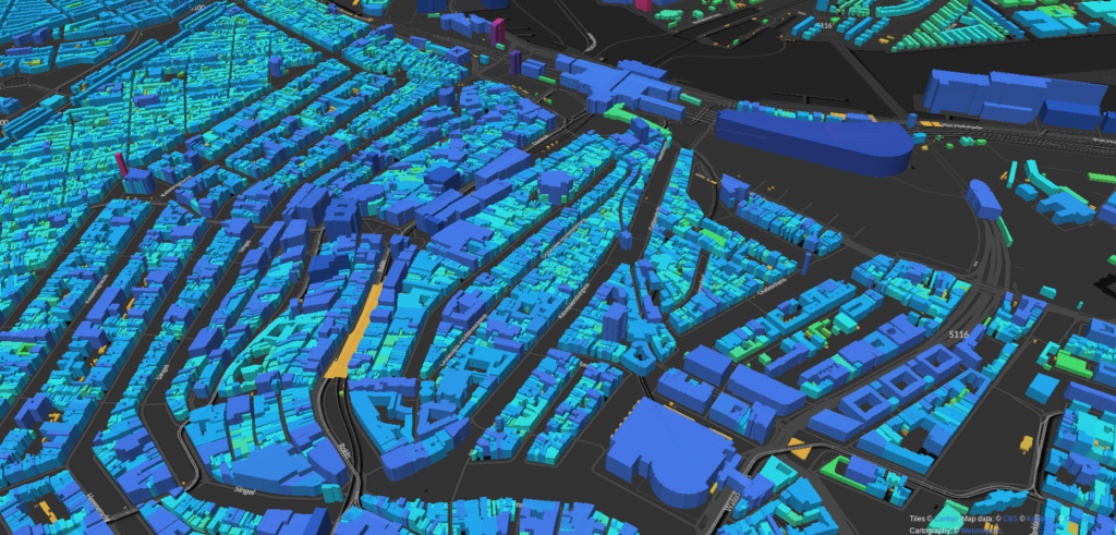
INTEGRATED SPATIAL DATABASES
Compiling, managing, and presenting geographic database layers for urban planning, environmental monitoring, agricultural land tracking, and smart city infrastructure.