EARTH OBSERVATION & REMOTE SENSING
Remote Sensing
Processing multi-band and hyperspectral satellite imagery to classify vast territories, monitor crop health, track environmental changes, and assess potential geohazard risks.
EARTH OBSERVATION & REMOTE SENSING
Processing multi-band and hyperspectral satellite imagery to classify vast territories, monitor crop health, track environmental changes, and assess potential geohazard risks.
SATELLITE & UAV OBSERVATION
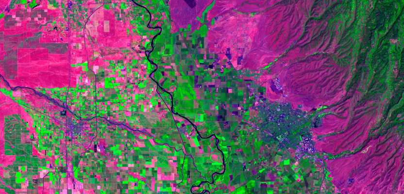
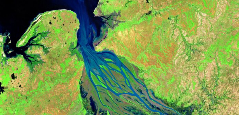
VibeGeo utilizes high-resolution multispectral and hyperspectral satellite imagery to map and classify large areas with exceptional detail. Our workflows enable decision makers and planners to construct efficient responses and form a deeper understanding of geographic risks.
High-resolution multispectral satellites allow detailed analyses of vegetation cover including plant health, species diversity, and structural variation. Satellites that include the Red-Edge band are uniquely capable of discriminating young vs. mature plants, classifying conifer vs. broad-leafed trees, and detecting early signs of crop stress.
CORE CAPABILITIES
We offer a robust suite of remote sensing services designed to translate pixels into actionable scientific insights.
Pre-processing, ortho-rectification, atmospheric correction, and multi-spectral signature extraction for reliable ground truth.
Employing machine learning algorithms and pixel/object-based classification to categorize complex spatial terrains.
Monitoring urban sprawl, deforestation, reservoir depletion, and environmental transformations over selected time periods.
Evaluating terrain elevation, water run-off routes, sun exposure, and geohazard landslide risk profiles using DEM datasets.
Producing standardized Land Use and Land Cover maps for regional planning, environmental assessments, and compliance.
Identifying canopy density, classifying forest stands, measuring broadleaf vs. conifer zones, and tracking health index.
Assessing crop yield, vegetation health indices (NDVI/EVI), water stress tracking, and soil moisture pattern classification.
Mapping geological rock structures, mineral exploration corridors, open-cast volume changes, and mining environmental impact.
Connect with our earth observation experts to design a tailored classification, mapping, or analysis solution for your specific requirements.
Talk to an Expert